There are many ways to reconstruct CO 2 in the past. The ice-cores from Antarctica represent the highest fidelity archive but only cover the last 800 thousand years. To reach further back in time we need to use indirect methods called "proxies". These proxies need careful calibration and extensive validation.
Our Mission
The geological past contains a rich archive of examples of Earth's climate system operating in warmer or colder states than today. Palaeoclimate studies can provide valuable insights into how the system operates in these altered climate states, often with important implications for our warming future.
Changes in the concentration of atmospheric CO 2 through the action of the carbon-cycle is a key driver of natural changes in climate. Therefore, to fully understand past climate change, and hence what it might mean for our future, we need accurate, precise, robust and high-resolution records of CO 2 through geological time.
There are multiple proxies available with new ones being developed all the time. Each proxy has its own strengths, weaknesses and complications. Yet the independence of each proxy means a combined approach will provide the most accurate reconstruction provided the uncertainties for each proxy has been fully explored and calculated.
Our Aims
The aims of the Palaeocean-CO 2 project are:
- To highlight where existing proxy validation and inter-comparison efforts are occuring.
- To provide a forum for discussion regarding marine-CO2 proxy intercomparison, validation and calibration.
- A place to post the latest news about CO2 proxies, highlight the latest publications and to advertise community activities (e.g. conference sessions and meetings).
- Compile and summarise the latest and best data for the expert and non-expert, and provide the latest understanding of each of the marine-based CO 2 proxies.
- Provide discussion of why some records are discarded by the "experts" in favour of new data and provide the latest understanding of each proxy.
- Provide a set of validation criteria/targets for existing and emerging proxies.
OUR APPROACH
All the proxies systems that are part of the Palaeocean-CO2 Project are based on the utilisation of marine sediments. Thanks to many years of ocean drilling (see here, above left and right) and a remarkable community effort there is an excellent, near continuous coverage of well-dated sediment stretching back at least 65 million years. This allows high-resolution climate and CO2 records to be generated on the same material.

Map of ODP drill sites (from IODP)
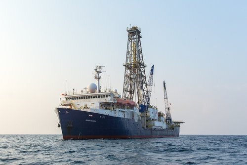
The Joides Resolution (IODP)
The image below shows the difference between the pCO2 of the surface ocean and the atmosphere (postive, hot colours = the ocean is a source of CO2 to the atm. and vice versa). As can be seen there are quite significant differences in places between atmosphere and ocean with respect to CO2 content. This means we need to be careful where we choose our sites and ideally use records from multiple locations to minimise the effect of changing CO2 disequilibrium.
